Coolest web feature ever!

Harryz

Tank
Joined
Jul 7, 2003
Messages
4,085
Reaction score
0
Google Map.

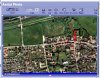
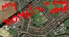
Basically you can get a satellite view of any place in America, such as your home or famous landmarks such as the Grand Canyon, Mount Rushmore or White House.

Heres one guy who has found Area 51 on the map, quite interesting.

Here are some links to famous Landmarks:
Ground Zero
Grand Canyon
Washington Monument
Boeing Factory

Directions
- Go to Google Maps website.
- Search for a destination
- Click "Satellite" on the top right corner.
- Enjoy. Also you can look around the surroundings.

Also, I know there is a thread sorta dedicated to this (Area 51 thread), but I thought it would be a good idea to start a proper where we can discuss other locations. I hope they bring a feature out like this for the UK.:E
 
Nevermind. Nice spotting of those landmarks. I found my house. :P
 
You didn't read the end of my post, did ya?

=(
 
I've seen a site with something like this, and it had a large part of the world (Land, not ocean heh) I saw my house, or at least, my house in 2001. Things have changed a lot around here since then.
 
Wow. I can see my apt. building. I can hardly see my house because the area is so wooded. Looks like the pictures were last updated for Grand Forks, ND last summer because there's a new apt. building next to mine that just went up in this last year.

EDIT: The Mall of America takes up more than one screen on the highest zoom setting. :o
 
Couldnt i just go outside if i wanted to see my house :/
 
I was at the apple store yesterday and i went to google maps on one of the powermacs hooked up to a 30" cinema display... Dear god that was awesome, i could see so much map on that screen
 
Wow! Are they "implementing" this awesome zoom for the rest of the world?
 
Valve doesn't have its headquarters on the waterfront....
 
I hope they hurry up and include the rest of the world. It'd be so easy to give people directions.
 
Y'arrr this would be my area

My area
 

Attachments

  • house_marked.jpg
    house_marked.jpg
    68.3 KB · Views: 125
You can compare the multimap.com photo of my house with the photo I took of my house from the air, its pretty funky :D
 

Attachments

  • myhouse.jpg
    myhouse.jpg
    84.7 KB · Views: 101
Farrowlesparrow said:
Oh... so you can't fly without a machine?


You just became less interesting ;(

Yeah, I thought he was the birdman of yorkshire-traz :(
 
Meh, you people are never happy.

Anyhows back on topic, I heard spaceimaging were planning on doing high-resolution imagery of the UK *soon* (they said this about 3 years ago) ... I wonder if they've got round to taking them yet.
 
lePobz said:
Meh, you people are never happy.

Anyhows back on topic, I heard spaceimaging were planning on doing high-resolution imagery of the UK *soon* (they said this about 3 years ago) ... I wonder if they've got round to taking them yet.

I hope to god they have, I'm not spending another day outside naked in the hope they catch me
 
here's my home!! :stare:

naked.. outside...? *runs to get periscope*
 

Attachments

  • homeaerial.jpg
    homeaerial.jpg
    90 KB · Views: 115
Back
Top